• Skip to main content
  • Skip to header right navigation
  • Skip to after header navigation
  • Skip to site footer
Florida Hikes logo

Florida Hikes

Hike Bike Paddle Camp Florida with authors Sandra Friend and John Keatley as your guides

  • Trails
  • Maps
  • Guidebooks
  • Hike
    • Scenic Hikes
    • Loop Trails
    • Dog-friendly Hikes
    • Hikes for Kids
    • National Parks in Florida
    • Florida State Parks
  • Bike
    • Major Bike Trails
    • Paved Bike Trails
    • Off Road Biking
    • Biking Articles
  • Paddle
    • Canoe & Kayak Rentals
    • Paddling Destinations
    • Paddling Articles
  • Camp
    • Cabin Rentals
    • Car Camping
    • Primitive Camping
  • Florida Trail
    • Plan your Hike
    • Best Scenic Hikes
    • Best Backpacking
    • Section Hiking
    • Thru-Hiking
    • Trail Updates
  • Travel
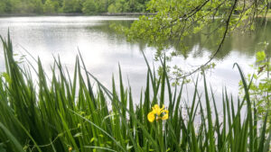
Yellow iris blooming along open water

Tom Brown Park

Gateway to two notable Tallahassee trails, Tom Brown Park has its own network of trails and a variety of recreation for all.

Tallahassee (30.44577, -84.21163)   3.1 miles  

On a drive through Tom Brown Park, a dizzying array of recreation choices present themselves across expansive grassy hillsides.

Extensive ballfields and tennis courts. Volleyball. Playgrounds. Numerous picnic pavilions.

Picnic pavilion One of many small pavilions in the park


Disc golf. A BMX track. A radio-controlled vehicle racetrack. A dog park. And more.

Digging deeper into its forested edges, you’ll find the park’s trails. From a gentle loop around Lake Leon to challenging singletrack, Tom Brown Park has paths for everyone.

Fence outlining trail over culvert in woods Crossing a tributary on the Nature Trails


Resources

Resources for exploring the area
Florida Trail Hikes book cover The Florida Trail Guide book cover North Florida Panhandle Explorers Guide book cover Hikers Guide to the Sunshine State book cover Paddlers Guide Florida
 
Disclosure: As authors and affiliates, we receive earnings when you buy through our links. This helps us provide public information on this website.

Overview

Location: Tallahassee
Length: 3.1 miles
Trailhead: 30.44577, -84.21163
Address: 501 Easterwood Dr, Tallahassee
Fees: Free
Restroom: Adjoining the playground
Land manager: City of Tallahassee
Phone: 850-891-3866

Open sunrise to sunset. Reserve picnic pavilions in advance.

Leashed dogs welcome, with off-leash allowed within the dog park.
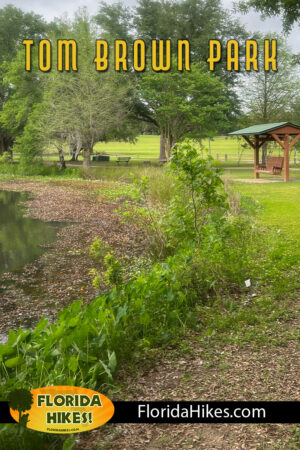
Covered swing along edge of pond


Directions


Driving east from downtown Tallahassee on US 90 (Tennessee St) or south along Capital Circle East (US 319) from Interstate 10, reach the intersection of the two highways and proceed south along Capital Circle to the light at Conner Blvd. Turn left and drive east a half mile to Easterwood Drive. Turn left. This road arcs through the ballfield portion of the park, but several narrow roads on the right lead downhill to parking areas adjoining the Goose Pond Trail, a paved path with access to all of the park’s trails.

About the Park

Devoted to outdoor recreation, Tom Brown Park provides a multitude of opportunities among 300 acres along the Lake Lafayette basin.

It’s the western anchor of a chain of public lands extending east and south more than fifteen miles along the St. Marks River basin.

Bottomland forest The park preserves an extensive bottomland forest


Our focus, of course, is its trails, but this city park has an outstanding number of family-friendly activities to enjoy, with its playgrounds and dog park particularly popular.

Expect to find the ballfields and courts along Easterwood Drive busy, and the disc golf course a draw for many, spread across the central hills of the park.

Fenced off dog park The dog park has separate enclosures for large and small dogs


Railroad tracks separate the park from marshy Lake Lafayette, but you can drop a line in Lake Leon for catch-and-release fishing.

Looped by an accessible trail and boardwalk, its a beauty spot in the southeast corner of the park.

Bench along a pond Lake Leon


Hike

Goose Pond Trail

It takes some exploration on foot or by bike to get your bearings on the trails within the park and where they diverge.

The one constant across them all is the Goose Pond Trail, a linear 1.8 mile arc spanning the entire park. Largely paved, it does have some rough spots.

Trailhead sign Southbound on the Goose Pond Trail


Parking within sight of the restrooms adjoining the largest playground, we took a walk southbound and found the dog park and Lake Leon.

A showy sinkhole pond with marshy edges, Lake Leon is circled by a 0.4-mile accessible loop, the boardwalk portion of which was closed for repairs.

Lake with boardwalk in distance Lake Leon


Walking northbound, it took no time at all to discover the official start of the Lafayette Heritage Trail at a massive kiosk and LH 1 marker.

A large unpaved parking area flanks the kiosk. The shared use Lafayette Heritage Trail starts here and extends through Lafayette Heritage Trail Park to the J.R. Alford Greenway.

Large trail kiosk Kiosk for the Lafayette Heritage Trail


While official sources claim a shorter route, our measured linear walk between the termini of the Lafayette Heritage Trail was 4.1 miles.

Two linear spur trails off that route, West Levee and Swift Creek, push the tally of marked trail for the Lafayette Heritage Trail to 5 miles.

Bridge and Lafayette Heritage Trail Park sign A prominent bridge connects these adjacent parks


Nature Trails

On a forested hillside and creek basin below the Goose Pond Trail, the Tom Brown Park Nature Trails immerse hikers in natural habitats.

Although a former loop between bridges appears to have been washed out and abandoned, we made a 1.3 mile loop along the trails off the Lafayette Heritage Trail.

Path in woods with trail marker Green diamonds with a “TB” mark the Nature Trails


The lower trails provided a panorama of wildflowers as ground cover in early spring, with jack-in-the-pulpit particularly prominent.

The upper portion of the loop grazes the hilltop within sight of the bustle of activity along the Goose Pond Trail.

Showy wildflower with pitcher shape Trailside jack-in-the-pulpit


Connector trails up and down the hillside make it possible to shorten the walk or enhance it, with a longer loop near Lake Leon meeting the Goose Pond Trail at two points.

The lower basin, with its cascades along tributaries flowing to a creek drainage into Lake Lafayette, muffles even the sound of activities in the open portions of the park.

A fork in the trail under tree cover Diverging paths in the bottomlands


Bike

Goose Pond Trail

For a 3.6 mile round-trip inside the park, the Goose Pond Trail is a natural choice for an easy ride.

Largely paved with moderate grades, it connects to all of the offroad trails in the park and extends beyond it by reaching sidepath at Conner Blvd at its south end.

paved trail in park Following the Goose Pond Trail


Fern Trail

At its north end, where the pavement ends, the 4.3 mile Fern Trail begins. This narrow singletrack leads west out of the park towards Governor’s Square Mall.

It’s tricky to navigate where it hops on roads briefly to connect broken segments, but makes a nice loop in Governor’s Park, with connectivity to a sidepath along Blair Stone Rd.

Man cycling singletrack towards overpass Start of the Fern Trail


Lafayette Heritage Trail

The prominent trail kiosk at the western terminus of the Lafayette Heritage Trail is the entry point for that doubletrack ride and the singletrack loops along it.

It’s also where you’ll ride downhill to turn off onto the West Cadillac Trail, a singletrack with blue diamonds, slicing through the wooded hillside into Lafayette Heritage Trail Park.

Sign with trail map in woods Start of the West Cadillac Trail along the Lafayette Heritage Trail


Nature Trails

Cyclists are welcome on the broader Tom Brown Nature Trails as well, which branches south from the Lafayette Heritage Trail soon after.

Marked with green diamonds, these trails extend a little more than a half mile south to Conner Blvd, meeting the Goose Pond Trail where it exits.

Tunnel like trail in woods with light at end South exit to Conner Blvd


Magnolia Mountain Bike Trail

Spanning from the West Cadillac Trail almost to the Fern Trail, the Magnolia Mountain Bike Trail is an extensive collection of singletrack loops on the steeply sloped hillside above.

A dedicated trailhead for these more challenging offroad trails is along Easterwood Dr north of the ballfields in the park, along with skills areas.

Sunlight filtering through forest The trails are in deep shade on wooded slopes


Trail Map

Tom Brown Park Trail Map
Light blue: Goose Pond Trail. Dark blue: Lake Leon Loop. Red: Nature Trails. Brown: Lafayette Heritage Trail.

Explore More!

Learn more about the Lafayette Heritage Trail.
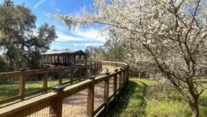
Boardwalk leading to a covered bridge past cherry blossoms Lafayette Heritage Trail Park Hike, bike, paddle, or fish along the well-marked trails of Lafayette Heritage Trail Park in a deeply wooded landscape east of downtown Tallahassee.

Video

A walk on the nature trails at Tom Brown Park


Slideshow

See our photos of Tom Brown Park


Nearby Adventures

Grassy trail with directional post J.R. Alford Greenway Preserving a peninsula in the Lake Lafayette basin for recreational use, the J.R. Alford Greenway is the eastern gateway to the Lafayette Heritage Trail.
Footbridge over a ravine on a slope Fort Braden Trails Showcasing bluff forests and deep ravines above Lake Talquin, the Fort Braden Trails at Lake Talquin State Forest offer enough hiking along a tiered trio of trails for a weekend in the woods.
Bear Creek Tract Lake Talquin State Forest With ten distinct tracts surrounding Lake Talquin, a reservoir along the Ochlockonee River, this state forest provides recreation opportunities just west of Tallahassee.
White azaleas blooming foreground in a woodland garden Alfred B. Maclay Gardens State Park Explore a true Tallahassee treasure on gentle garden paths amid plantings dating back to 1923 or along well-trodden trails into wild woodlands along Lake Hall and Lake Overstreet.

Park Map (PDF) Mountain Bike Trail Map (PDF) Official Website

  • Author
  • Recent Posts
Sandra Friend & John Keatley
Articles jointly researched, written, and photographed by Sandra Friend & John Keatley, authors and publishers of FloridaHikes.com.
Sandra Friend & John Keatley
Latest posts by Sandra Friend & John Keatley (see all)
  • Hal Scott Yellow Trail - November 3, 2026
  • Hal Scott Preserve - October 28, 2026
  • Tradewinds Park - October 27, 2026
Category: Biking, City Parks, Day Hikes, Hikes, Loop Hikes, Nature Trails, Northwest Florida, Off Road Biking, Parks, Paved Bike Trails, TrailsTag: Dog-friendly, Family-Friendly, Fishing, Hilly Trails, Lafayette Heritage Trail, Picnic, Playgrounds, Tallahassee

Sidebar

FarOut Guides

Our comprehensive trail logistics presented on offline maps:

Florida National Scenic Trail (1,500 miles)
Florida Keys Overseas Heritage Trail (108 miles)
Eastern Continental Trail in Florida (92 miles)


We earn a small commission on sales through these links. Thanks for your support!


Our Guidebooks

We’ve written Florida guidebooks for over 25 years. These include Northwest Florida destinations.

Book cover with woman hiking through palms with baby carrier
Book cover of Florida Trail Hikes
The Florida Trail Guide fifth edition
Explorer's Guide North Florida & The Panhandle guidebook

Explore More

Newest Articles for Northwest Florida

Footpath in lush river hammock Florida Trail, Wakulla River
Expanse of lake Jackson View Park
Large pond with a boardwalk on its far shore Pedrick Pond Park
Sweep of bay beyond dunes and path through them Okaloosa Area

  • Facebook
  • Flickr
  • Instagram
  • Pinterest
  • Substack
  • Vimeo

FIND A TRAIL OR PARK

METROS: Bradenton. Clearwater. Crestview. Daytona Beach. Destin. Fort Lauderdale. Fort Myers. Fort Walton Beach. Gainesville. Jacksonville. Kissimmee. Lakeland. Melbourne. Miami. Naples. Ocala. Orlando. Panama City Beach. Pensacola. Port St. Lucie. Punta Gorda. St. Petersburg. Sanford. Sarasota. Sebring. Stuart. Tallahassee. Tampa. Vero Beach. West Palm Beach.

MULTI-REGION: Atlantic Coastal Ridge. Atlantic Coast. Bartram Trail. Big Bend. East Coast Greenway. Everglades National Park. Florida National Scenic Trail. Gulf Coast. Lake Wales Ridge. WATERWAYS: Indian River Lagoon. Intracoastal Waterway. Kissimmee River. St. Johns River. Withlacoochee River.

NORTHWEST FLORIDA: Altha. Apalachicola. Apalachicola National Forest. Big Bend Scenic Byway. Blackwater River State Forest. Blountstown. Bonifay. Bristol. Bruce. Cantonment. Cape San Blas. Carrabelle. Chattahoochee. Chipley. Crawfordville. DeFuniak Springs. Eastpoint. Ebro. Eglin Air Force Base. Freeport. Fountain. Gulf Breeze. Gulf Islands National Seashore. Holt. Madison. Marianna. Milton. Monticello. Mossy Head. Munson. Navarre. Navarre Beach. Newport. Niceville. Panacea. Panama City . Perdido Key. Ponce De Leon. Port St. Joe. Quincy. Santa Rosa Beach. Sopchoppy. South Walton. St. George Island. St. Marks. St. Marks NWR. Sumatra. Vernon. Wakulla. Wewahitchka. Woodville. WATERWAYS: Apalachicola River. Blackwater Bay. Blackwater River. Chipola River. Choctawhatchee Bay. Choctawhatchee River. Coastal Dune Lakes. Ochlockonee Bay. Perdido River. St. Marks River. Wacissa River. Wakulla River. Yellow River.

NORTH FLORIDA: Alachua. Amelia Island. Archer. Baldwin. Branford. Bronson. Bunnell. Callahan. Cedar Key. Chiefland. Crescent City. Cross City. Cross Creek. Dowling Park. Ellaville. Fanning Springs. Fernandina Beach. Flagler Beach. Fort White. Glen St. Mary. Green Cove Springs. Hawthorne. High Springs. Inglis. Jacksonville Beaches. Jacksonville Northshore. Jasper. Jennings. Keystone Heights. Lake Butler. Lake City. Live Oak.Macclenny. Mandarin. Mayo. Mayport. Micanopy. Middleburg. Old Town. Olustee. Orange Park. Osceola National Forest. Palatka. Palatka-Lake Butler Trail. Palm Coast. Palm Valley. Perry. Ponte Vedra. Rodman. Salt Springs. St. Augustine. Starke. Steinhatchee. Suwannee. Suwannee River Wilderness Trail. Suwannee Springs. Talbot Islands. Timucuan Preserve. Trenton. Waldo. Welaka. White Springs. Williston. Worthington Springs. Yankeetown. WATERWAYS: Santa Fe River. St. Marys River. Suwannee River. Tolomato River. Upper Withlacoochee River.

CENTRAL FLORIDA: Altamonte Springs. Apollo Beach. Apopka. Astatula. Astor. Auburndale. Bartow. Babson Park. Bayport. Belleview. Bithlo. Brandon. Brooksville. Bushnell. Canaveral National Seashore. Cassadaga. Christmas. Chuluota. Citrus Springs. Clearwater Beach. Clermont. Coast to Coast Trail. Cocoa. Cocoa Beach. Cross Florida Greenway. Crystal River. Dade City. De Leon Springs. DeBary. Deland. Deltona. Dunedin. Dunnellon. Edgewater. Enterprise. Eustis. Ferndale. Fort Meade. Frostproof. Geneva. Gibsonton. Haines City. Hernando. Hernando Beach. Holopaw. Homosassa. Inverness. Kenansville. Kissimmee. Lake Mary. Lake Wales. Largo. Leesburg. Lithia. Longwood. Lutz. Maitland. Malabar. McIntosh. Melbourne Beach. Merritt Island. Merritt Island NWR. Mims. Mount Dora. Narcoossee/Lake Nona. New Port Richey. New Smyrna Beach. Nobleton. Oak Hill. Oakland. Ocala National Forest. Ocklawaha. Ocoee. Oldsmar. Orange City. Ormond Beach. Osteen. Oviedo. Paisley. Palm Bay. Plant City. Poinciana. Polk City. Ponce Inlet. Port Orange. Ridge Manor. Riverview. Ruskin. Safety Harbor. Silver Springs. Sorrento. Spring Hill. St. Cloud. Tarpon Springs. Thonotosassa. Titusville . Umatilla. Viera. Walt Disney World. Weeki Wachee. Weirsdale. Wimauma. Windermere. Winter Garden. Winter Haven. Winter Park. Winter Springs. Withlacoochee State Forest. Withlacoochee State Trail. Yeehaw Junction. Zephyrhills. WATERWAYS: Alafia River. Halifax River. Hillsborough River. Lake Apopka. Little Manatee River. Ochlawaha River. Rainbow River. Tampa Bay. Wekiva River. Wekiva River Basin.

SOUTHWEST FLORIDA: Alva. Boca Grande. Cape Coral. Charlotte Harbor. Ding Darling NWR. Ellenton. Englewood. Estero. Immokalee. Marco Island. North Port. Osprey. Palma Sola. Palmetto. Pine Island. Port Charlotte. Sanibel Island. Venice. WATERWAYS: Caloosahatchee River. Manatee River. Myakka River. Pine Island Sound.

SOUTH FLORIDA: Arcadia. Basinger. Big Cypress National Preserve. Big Cypress Seminole Reservation. Big Cypress Swamp. Bowling Green. Clewiston. Everglades City. Indiantown. LaBelle. Lake Okeechobee Scenic Trail. Lake Placid. Lakeport. Moore Haven. Okeechobee. Ortona. Pahokee. Palmdale. Port Mayaca. South Bay. Wauchula. Zolfo Springs. WATERWAYS: Fisheating Creek. Lake Okeechobee. Peace River.

SOUTHEAST FLORIDA: Biscayne Bay. Biscayne National Park. Boca Raton. Boynton Beach. Coconut Creek. Coral Gables. Coral Springs. Davie. Delray Beach. Fellsmere. Flamingo. Fort Pierce. Hobe Sound. Hollywood. Homestead. Indrio. Jensen Beach. Juno Beach. Jupiter. Jupiter Farms. Key Biscayne. North Hutchison Island. Ocean to Lake Greenway. Palm Beach. Palm Beach Gardens. Pompano Beach. Redland. Sebastian. South Hutchinson Island. WATERWAYS: Florida Bay. St. Lucie River.

FLORIDA KEYS: Big Pine Key. Islamorada. Key Largo. Key West. Marathon. Overseas Heritage Trail.


©2006-2026, Sandra Friend & John Keatley | Disclosure | Site Index | Work with Us | Advertise with Us | Terms of Service and Privacy Policy

Florida Hikes PO Box 93 Mims FL 32754 | Contact
